The Kawarthas — Redline Lake and the Trent-Severn
The Kawartha Lakes region, roughly 150 km northeast of Toronto, offers a mix of lake paddling and river travel along the Trent-Severn Waterway. The waterway is managed by Parks Canada and includes 44 locks connecting Lake Ontario at Trenton to Georgian Bay at Port Severn.
For kayakers, the Kawarthas offer relatively calm freshwater paddling with established put-in points at municipal boat launches and conservation areas. Redpine Lake, near Havelock, is used as a staging point for multi-day trips into the wider Kawartha Highlands. The Kawartha Highlands Provincial Park contains designated campsites accessible only by water or trail, and a backcountry permit from Ontario Parks is required.
Permit Note: Ontario Parks backcountry permits are sold on a per-person, per-night basis. During peak season (late June through Labour Day), reservations are strongly recommended as quotas apply on some routes.
Lake Temagami
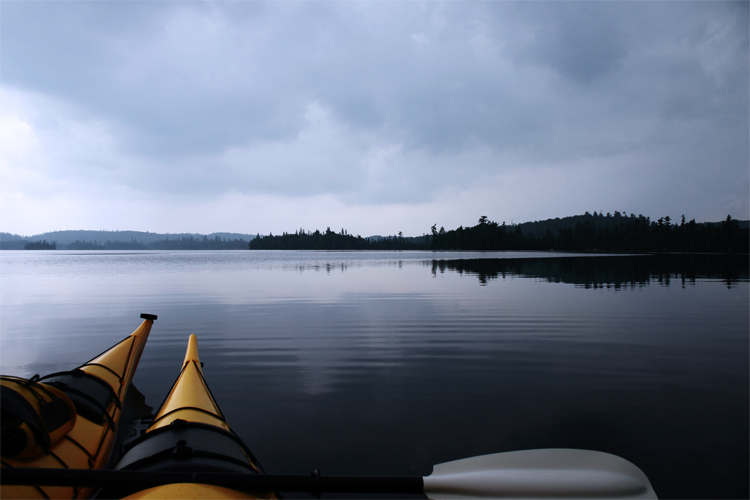
Lake Temagami, located approximately 100 km north of North Bay, is one of Ontario's deepest lakes and historically significant as both a wilderness destination and a site with strong ties to the Teme-Augama Anishnabai First Nation. The lake's shoreline and surrounding Crown land contain a network of portage trails that connect dozens of smaller lakes.
The town of Temagami serves as the main access point, with boat launches at Finlayson Point Provincial Park and Ferguson Bay. Multi-day routes typically travel north into the Wakimika Triangle or south toward Lake Obabika, with portages ranging from a few hundred metres to several kilometres.
Water clarity in Temagami is high, and the area has historically been managed as a low-impact wilderness zone. Open fires are regulated — check current Ontario fire zone restrictions before departing, particularly in summer.
Typical Route Distances — Temagami
| Route | Distance | Portages |
|---|---|---|
| Temagami town to Diamond Lake loop | ~50 km | 8–10 portages |
| Ferguson Bay to Obabika Lake | ~35 km one way | 4–6 portages |
| Finlayson Pt to Wakimika Triangle | ~45 km loop | 6–9 portages |
Algonquin Provincial Park
Algonquin, established in 1893, is Ontario's oldest provincial park and contains over 1,500 km of canoe and kayak routes. The park is divided into an interior zone accessible only by non-motorized boat or trail, and a corridor zone with more mixed use along Highway 60.
Interior campsites are reserved through Ontario Parks and carry a daily fee. Quotas are applied to some access points during summer weekends. Portage trails in Algonquin are generally well-maintained and marked, with distances indicated on park maps.
The park's Wildlife Research Station has produced substantial data on the ecology of the region, and the Algonquin Park official website maintains current entry condition reports, including water levels and portage trail status.
Seasonal Conditions
Ice typically leaves Ontario's Shield lakes between mid-April and mid-May, depending on latitude and the preceding winter. Late May through September represents the primary paddling season. Water temperatures in June can still be cold enough to make capsizing dangerous without a wetsuit or drysuit, particularly in deeper Shield lakes.
Biting insects — primarily black flies and mosquitoes — are active from late May through mid-July. Long-sleeved clothing and head nets are standard on many trips during this period.
Access and Logistics
Most Kawartha and Temagami routes require a vehicle to reach the put-in and a shuttle arrangement or loop route to return to the starting point. Shuttle services are available through local outfitters. Algonquin interior access points are reachable from Highway 60 (south side) or via Highway 17 to the north entry points at Brent and Achray.
Outfitter rentals of kayaks and camping equipment are available in Temagami and at multiple locations along Highway 60 in Algonquin. Most outfitters can provide topographic maps specific to planned routes.

